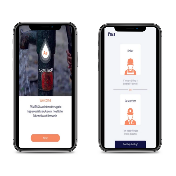
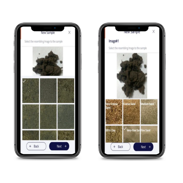
ASMITAS is a cutting-edge computational platform that is available as a cloud-based or node-based framework. In minutes, a node-based analytic tool may provide As profiling. The reference tool is improved by reference sediment images, and state-of-the-art techniques are used to capture images of new samples and normalized image data that is compared with the reference library.
The regression is completed using predictive analysis methods, which forecast aquifers with healthy levels of As in groundwater at a given depth. On the basis of real-time analysis of water samples and the incorporation of new hyperspectral image data of sediment color from broader geographical areas with diverse color specificities, this can be refined further.
Contamination of groundwater with arsenic (As) is a public health problem in many parts of the world, and its poisonous nature has affected a significant number of people. A comprehensive study conducted in Bangladesh found a close connection between aquifer sediments and arsenic concentration in groundwater.


In Bangladesh, a novel handheld sediment color tool was developed in collaboration with local drillers to help local drillers target healthy aquifers for tube-well construction. This research aimed to evolve a solution that is a completely artificial intelligence (AI) based digital ASMITAS (Arsenic Mitigation at Source) tool based on spectral scanning of sediment color.
From a given object continuous spectral channels are captured with HSI camera ranging from IR bands to VR and UV ranges, and generates a more detailed imaging performance than conventional RGB data-based color cameras, improving color perception with greater accuracy and precision.
This new tool can be scaled to cover a wide geographic area, making it a valuable tool for local drillers and other stakeholders in making informed decisions about the construction of secure tube-wells to mitigate As at the source.

ASMITAS(SWEDEN) is a platform that combines an advanced image analytic solution and the know-how of the local drillers to quickly validate the quality of water in real-time without using any chemical agents.

All this is done while drilling for new tube wells in arsenic-affected regions. This cost-effective solution can be used even in remote areas as long as the mobile app is in their hand

Designed to enable geological mapping of aquifers and the arsenic contents across the globe so that recommendation can be provided upfront before drilling starts
Why ASMITAS
Speed
- Test results will be in minutes
- Simple app (with optional device attached) hence you use it anywhere
Cost Effective
- With the assumption that every stakeholder has mobile phone, zero additional cost
Smart
- Leverages advanced cloud based machine learning platforms, can learn and provide recommendations
Secure
- Blockchain enabled security where there is no chance data tampering