


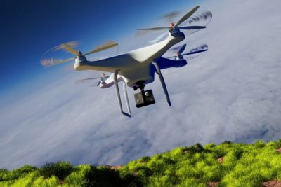
Enabling Technologies Powering Autonomous Drones
The Cognitive Engine of Autonomous Drones
Artificial Intelligence (AI) forms the neural core of autonomous drones, providing them with the intelligence to perceive, process, and respond to their environment in real time. Machine Learning (ML) models, particularly those trained on massive aerial datasets, continuously improve drones’ decision-making capabilities.

Key Capabilities:
- Autonomous Navigation: Drones use deep reinforcement learning to map optimal paths, avoid dynamic obstacles, and recalibrate routes based on environmental changes—without GPS dependency in some cases.
- Computer Vision for Object Detection: Convolutional Neural Networks (CNNs) help drones distinguish between humans, animals, infrastructure, and vegetation. This enables real-time decision-making during surveillance, inspections, and disaster response.
- Terrain Mapping & SLAM (Simultaneous Localization and Mapping): SLAM algorithms allow drones to construct 3D maps of their surroundings while simultaneously tracking their own location, crucial in GPS-denied environments like forests or underground mines.
- Predictive Analytics: AI models analyze patterns in collected data (e.g., identifying early signs of crop disease or infrastructure fatigue) and generate predictions to inform preemptive actions.
- Learning from Feedback: Drones continuously refine their models using new data gathered during missions, improving flight stability, obstacle handling, and energy efficiency over time.
Seeing and Understanding the Physical World
Computer vision allows drones to process vast volumes of visual data captured from onboard cameras and sensors. It converts raw imagery into high-fidelity insights for autonomous decision-making.

Core Functionalities:
- Semantic Segmentation: Enables pixel-level understanding of environments (e.g., differentiating roads from vegetation) which is critical for precision landing, surveillance, and infrastructure inspection.
- Photogrammetry & 3D Reconstruction: Aerial photogrammetry allows drones to generate dense 3D point clouds and orthomosaic maps, useful for construction monitoring, land surveying, and digital twin generation.
- Thermal & Multispectral Imaging Integration: Visual data can be fused with thermal and multispectral imagery to identify heat leaks, moisture stress, and other anomalies invisible to the naked eye.
- Anomaly Detection Algorithms: ML-powered vision systems flag irregularities in visual data, such as cracks in bridges or leaks in pipelines, triggering alerts for human review or automated response.
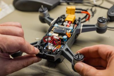
The Sensory Organs of Intelligent Drones
Drones are becoming multi-sensor fusion platforms, equipped with a wide variety of payloads tailored for specific missions. These sensors expand drones’ capabilities across diverse industries.
Types of Sensors and Use Cases:
- LiDAR (Light Detection and Ranging):
- Generates detailed 3D point clouds for topographic mapping, volumetric analysis, and infrastructure modeling.
- Used in mining, forestry, construction, and disaster assessment.
- Generates detailed 3D point clouds for topographic mapping, volumetric analysis, and infrastructure modeling.
- Multispectral & Hyperspectral Cameras:
- Capture wavelengths beyond visible light, enabling plant health assessment, soil composition analysis, and environmental monitoring.
- Critical for precision agriculture and conservation biology.
- Capture wavelengths beyond visible light, enabling plant health assessment, soil composition analysis, and environmental monitoring.
- High-Sensitivity Thermal Cameras:
- Detect temperature variations to locate electrical faults, missing persons, or overheating machinery.
- Used in firefighting, energy inspections, and search-and-rescue.
- Detect temperature variations to locate electrical faults, missing persons, or overheating machinery.
- Gas and Environmental Sensors:
- Measure air quality, detect gas leaks (e.g., methane, carbon monoxide), and radiation levels.
- Valuable for smart city applications, industrial safety, and climate studies.
- Measure air quality, detect gas leaks (e.g., methane, carbon monoxide), and radiation levels.
- High-Resolution RGB Cameras:
- Provide visual fidelity for inspections, documentation, and photogrammetry.
- Used in insurance, real estate, and urban planning.
- Provide visual fidelity for inspections, documentation, and photogrammetry.
- Radar Systems (e.g., SAR – Synthetic Aperture Radar):
- Enable operations in poor visibility conditions like fog, rain, and night.
- Suitable for military surveillance and flood monitoring.
- Enable operations in poor visibility conditions like fog, rain, and night.
- Acoustic Sensors:
- Monitor noise pollution or track wildlife based on vocalizations.
- Emerging use in predictive maintenance via sound anomaly detection.
- Monitor noise pollution or track wildlife based on vocalizations.
- Sensor Fusion:
- Combining multiple sensors (e.g., LiDAR + RGB + Thermal) allows drones to generate richer, multi-dimensional insights and improves reliability in edge cases.
Intelligence at the Edge—Not in the Cloud
Autonomous drones require immediate processing capabilities to make decisions without relying on distant cloud servers. This is where Edge AI and high-performance onboard processors come into play.

Advantages of Edge Processing:
- Real-Time Analytics: Onboard GPUs or TPUs enable complex ML inference tasks—like identifying structural defects or classifying objects—during flight.
- Zero-Latency Decision-Making: Immediate threat avoidance, emergency landing, or path recalibration is made possible by edge compute capabilities.
- Disconnection-Resilient Autonomy: In regions with poor connectivity (e.g., remote forests, disaster zones), drones can continue operating with minimal data transmission.
- Reduced Bandwidth Costs: Only critical metadata or anomaly reports are uploaded to the cloud, lowering bandwidth usage while maintaining operational efficiency.
- Energy Optimization through AI: AI models running locally help optimize battery usage, reroute paths based on energy constraints, and estimate return-to-base time windows.
Enabling Long-Endurance, Green Flights
Power systems are a bottleneck for drone autonomy. Innovations in battery tech and energy management are enabling longer, smarter, and greener operations.
Technological Innovations:
- High-Density Li-ion and Solid-State Batteries: Deliver extended flight times with lower weight and enhanced safety, critical for heavy-payload operations.
- Battery Swapping Stations: Deployed at mission sites to enable quick battery replacement for uninterrupted surveillance or logistics operations.
- Solar Power Integration: Lightweight solar panels embedded in drone wings or rotor arms extend flight duration for long-range, sunny-environment missions.
- Hybrid Power Systems: Drones using fuel cells or hybrid engines for persistent aerial monitoring (e.g., border surveillance, wildlife tracking).
- AI-Based Power Management: Algorithms predict battery performance under different mission loads, dynamically adjusting altitude, route, and payload operations to conserve energy.
Real-Time Data Flow and Fleet Coordination
Connectivity is essential for remote control, data transmission, and synchronized multi-drone operations. 5G and edge networking dramatically boost drone system responsiveness and reliability.

Connectivity-Driven Advantages:
- Ultra-Low Latency Communication: Enables real-time drone control, ideal for precision agriculture, industrial inspection, and real-time crowd monitoring.
- High-Bandwidth Streaming: Supports HD video feeds and rapid transmission of large sensor datasets (e.g., multispectral maps) to ground stations or cloud platforms.
- BVLOS (Beyond Visual Line of Sight) Operations: Required for drone delivery, wide-area monitoring, and autonomous corridor mapping—enabled by persistent, low-latency links.
- Fleet Management & Swarm Intelligence: 5G supports coordinated path planning and collision avoidance across fleets, opening doors for logistics, search missions, and aerial survey swarms.
- Cloud Offloading for Long-Term Analysis: Large volumes of sensor and vision data can be offloaded to the cloud for historical tracking, pattern mining, or AI model training.